
How CADPro’s BIM Modeling Covers Civil, Industrial, and Oil & Gas Projects in Qatar
BIM Modeling Services aren’t just for buildings. At CADPro, our Building Information Modeling covers civil infrastructure, industrial facilities, and oil & gas projects — sectors where coordination errors carry much higher stakes than typical residential or commercial construction.
Civil 3D Modeling Services
Our BIM workflow includes dedicated Civil 3D Modeling for infrastructure projects across Qatar:
- Terrain modeling, site grading, and drainage design based on real topography
- Utility layouts and utility corridor coordination — water, sewer, electrical, and telecom — to avoid conflicts before excavation
- Road design and pavement layouts aligned with surrounding infrastructure
- Earthwork quantities calculated directly from the 3D model
- Structural modeling and MEP systems coordination, supporting full construction documentation and project planning
Every Civil 3D model connects into the same coordinated BIM environment used for structural and MEP design, so infrastructure work isn’t handled in isolation from the rest of the project.
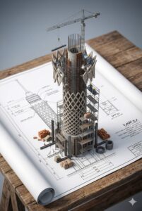
QP Standard Drawings (ESD.10 & ESD.18) and Oil and Gas Refinery Drawings
CADPro produces drawings formatted to Qatar Petroleum’s ESD.10 and ESD.18 documentation standards, with correct layer, annotation, and format requirements built in from the start, and full familiarity with QP’s review and approval workflow — reducing resubmission cycles and avoiding costly delays.
For oil and gas refinery projects specifically, covering refineries, pipelines, and storage facilities, this extends to piping and instrumentation coordination with structural and civil elements, equipment layouts that account for maintenance access and safety clearances, structural steel detailing for pipe racks and process support structures, and as-built documentation for existing refinery infrastructure before any expansion work begins.
BIM Coordination Using Industry-Standard Software
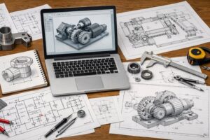
CADPro delivers 3D BIM Modeling and coordination services using the full Autodesk suite:
- Revit — for architectural, structural, and MEP systems coordination
- Civil 3D — for terrain modeling, road design, and utility layouts
- Navisworks — for clash detection and multi-discipline model coordination
Running Revit, Civil 3D, and Navisworks together as one workflow keeps every discipline — architectural, structural, civil, and MEP — working from the same coordinated model, whether the project is a commercial building, an infrastructure package, or an engineering project tied to Qatar’s oil and gas sector. This approach aligns with the Qatar Construction Standards (QCS) framework followed across the country’s construction industry.

Conclusion
CADPro’s BIM Modeling Services go beyond typical building work, extending into Civil 3D Modeling, QP Standard Drawings, and Oil and Gas Refinery Drawings — sectors where a missed coordination detail can mean far more than a cost overrun. By running civil, structural, MEP, and regulatory documentation through one coordinated workflow built on Revit, Civil 3D, and Navisworks, CADPro catches conflicts before they surface during construction or, in an operational refinery, during actual use.